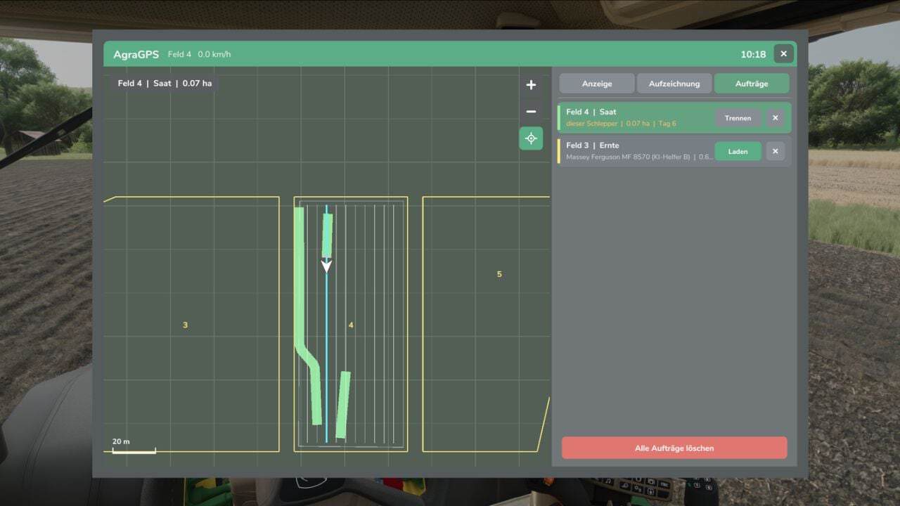
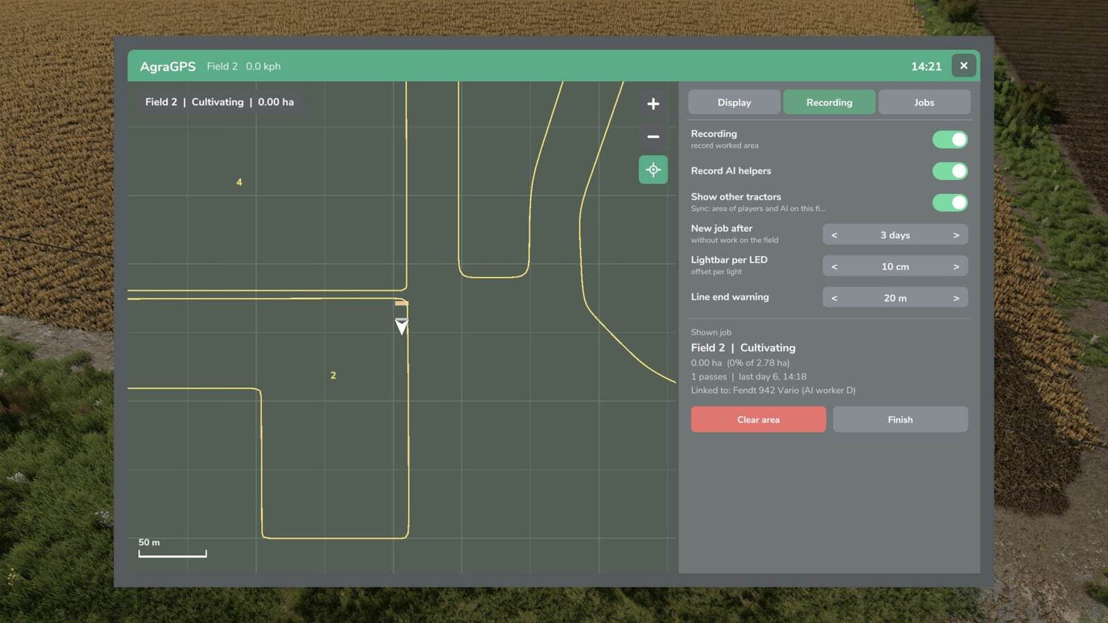
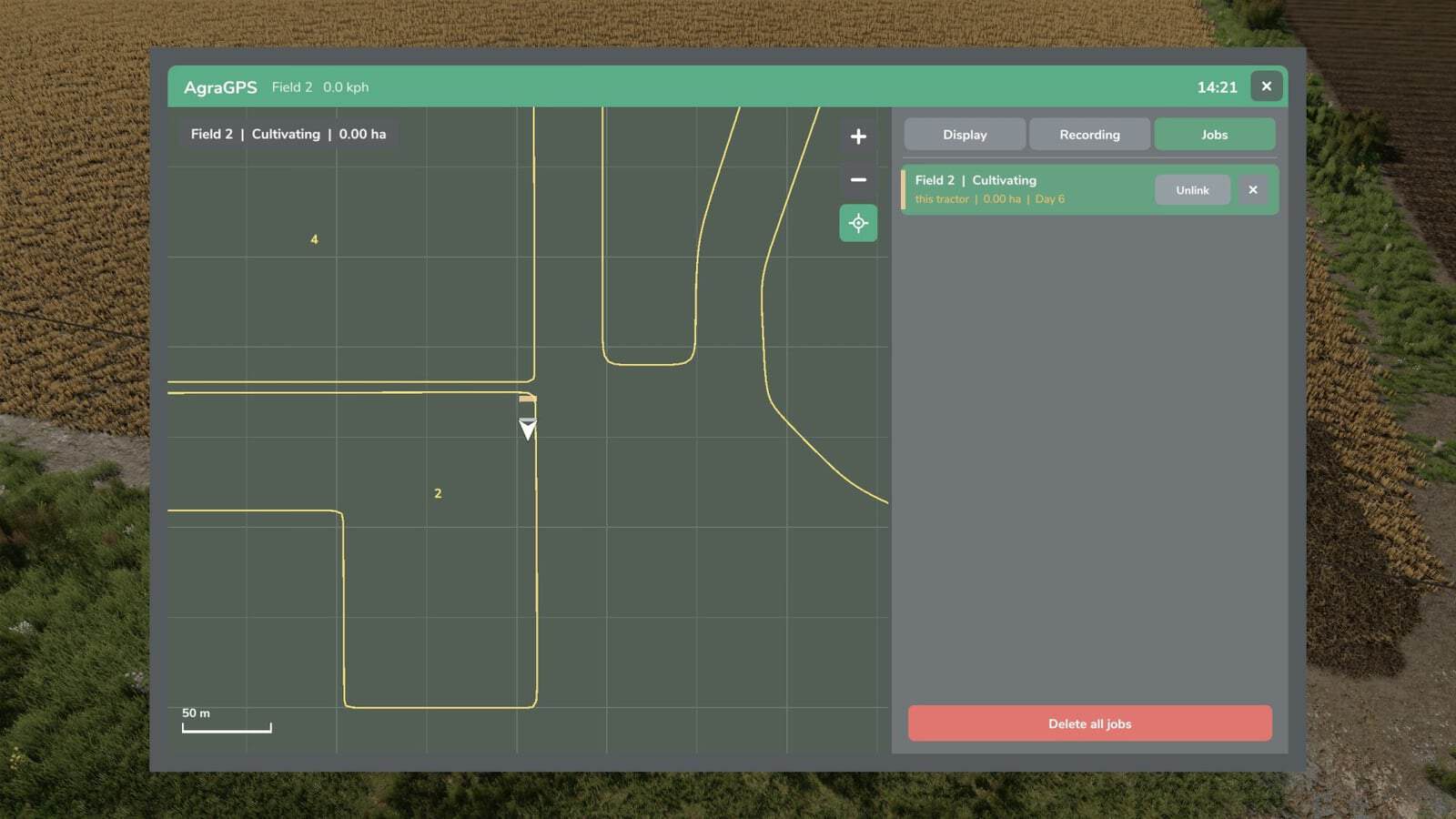
FS25 AgraGPS V1.1.0.0
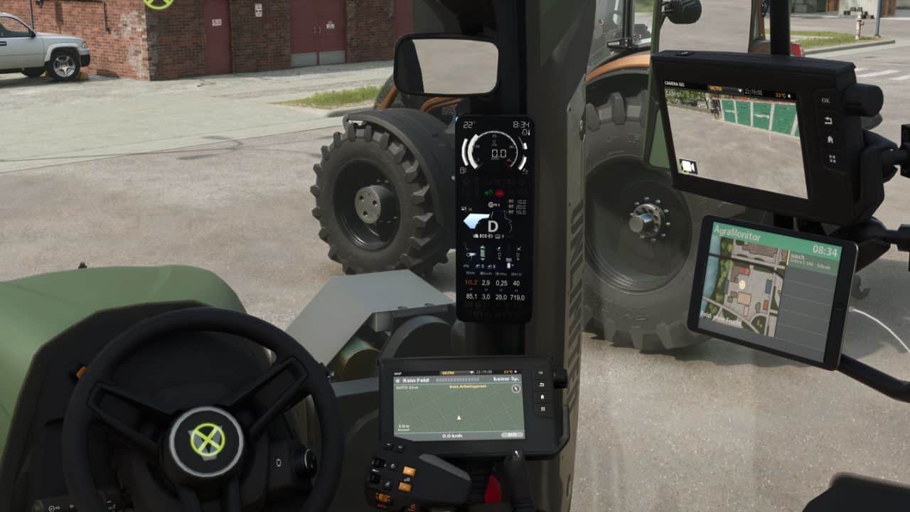
AgraGPS adds an optional GPS display and a user interface for course management to Farming Simulator 2025. These functions are available for pre-configured vehicles.
Features
- The complete lane guidance screen shows all lane guidance lines.
- The area worked by the attached device is shown and recorded. It remains visible after saving or leaving the field when work continues later.
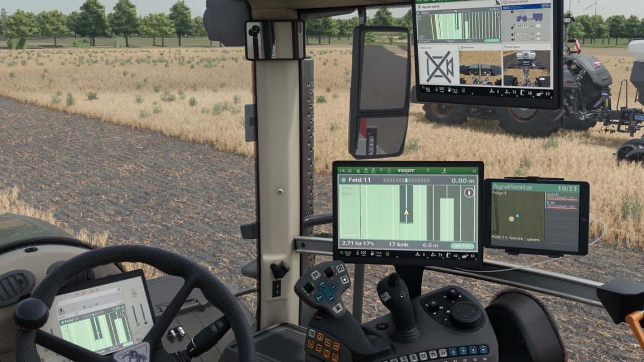
- An optional GPS terminal screen is available for the cabin.
- Several screens can be used and operated independently.
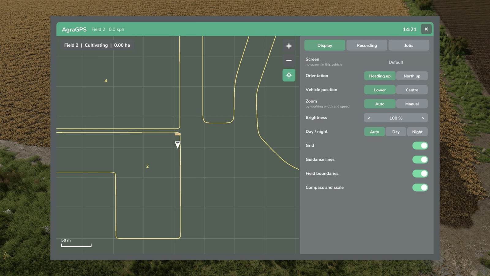
- The display presents the worked area, field boundaries, and steering assist lines.
- Worked areas can be recorded.
- Recordings are stored for each field and work type, connected to the tractor and available for other tractors, AI helpers, and players in multiplayer.
- A terminal provides an overview map and extensive settings. Open it with
Alt left + G(this can be changed in the control menu).
Changelog
V1.1.0.0
- Fixes:
- Combined fields are recorded as one entry. The name will then be, for example, Field 3 + Field 4, etc.
- The free space located between two combined fields is now recorded as well.
- Font sizes that became excessively large in the screens, making attributes unreadable, have been fixed.
- The sync function for two tractors working in one field caused problems and has been removed.
- New:
- Vehicles without a screen or external view player now receive a GPS window. It can be adjusted like the screens through the GPS menu and opens with
Alt left + H(changeable in the control menu). - Using the GPS menu, the GPS window can be docked on the left, right, top, or bottom and resized.
- GPS screen and window colors can be personalized in the GPS menu and are connected to the vehicle type.
- The recording of worked areas has been revised. Shared recording takes place only when two tractors have loaded the same recording.
- AI helper recording can now be switched on separately for every helper.
- Automatic deletion after X days has been removed.
- The screen can now work without text and LED strip attributes. Set the attribute value
onlyMapLayertotruein the XML file for this. - Note on the recording process:
- A field recording always begins, no matter which task is being carried out in the field, even when guidance is not active.
- Starting a task in the field begins recording automatically and connects your vehicle with that recording.
- For an AI helper or another player to carry out the same field task, the existing recording must be loaded. Both vehicles then record the work in that recording.
- Without loading the recording, the AI helper or other player starts a new recording, even when the task is identical.
- When the field is finished, complete the task in the GPS menu. It is then saved and can later be opened to check whether the complete area has been worked.
- After an area is complete, it cannot be loaded again. It can only be viewed or deleted.
- Incomplete areas may be loaded into a vehicle at any time.